Formby BeachThe independent visitor guide

Explore Formby Beach

Miles of sand, a restless line of dunes and a pinewood with red squirrels in it. What there is to see and do, how to walk it, and how this coast came to look the way it does.

About Formby Beach

Formby Beach is on the Sefton coast in Merseyside, about half an hour north of Liverpool by train and a quarter of an hour south of Southport. It faces west across the Irish Sea, and at low water the sand is very wide and very flat.

Behind the beach is one of the most important sand dune systems in north-west Europe, and behind the dunes are pinewoods planted from the late 1800s onwards. The whole coast is a Site of Special Scientific Interest and part of the Sefton Coast Special Area of Conservation, protected for its dunes, its dune pools and the rare animals that live in them.

The National Trust has cared for land here since 1967, when it bought the northern shore and sandhills through its Enterprise Neptune coastal appeal. It took on the land around Lifeboat Road from Sefton Council in 2017, and now looks after an area it describes as about the size of 700 football pitches. More than a million visits were made in 2025.

This is a coast that moves. The sea is eroding the dunes at Formby Point and the dunes are rolling inland. In 2025 the National Trust removed the car park that stood behind the beach at Victoria Road, together with 80,000 tonnes of wartime rubble beneath it, so the dunes could rebuild naturally. That is why the car parks are now set back in the woods, and why the walk to the sea is longer than older guides suggest.

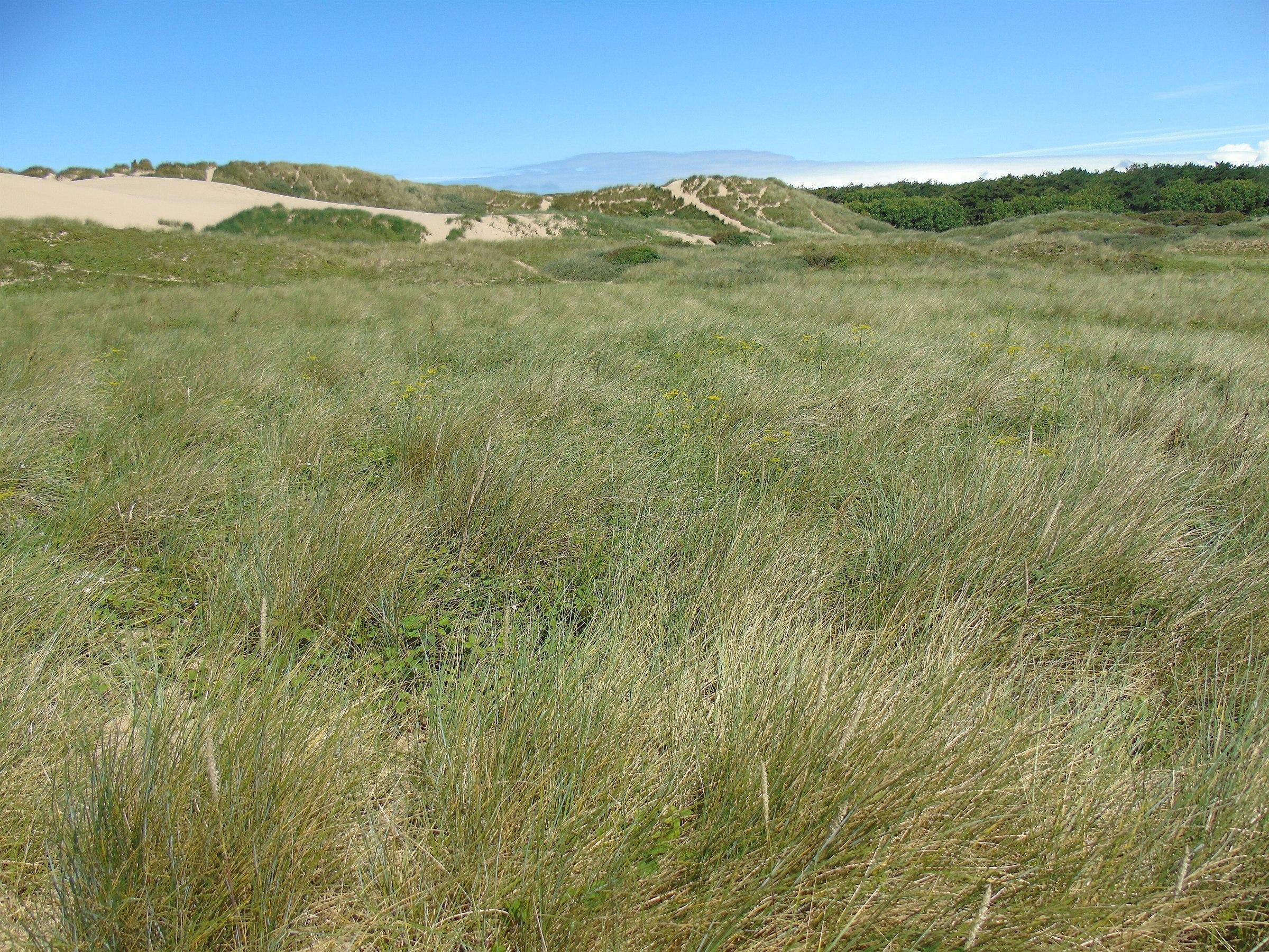
Marram grass covers rolling dunes at Formby Point, with bare sand slopes and pine woodland in the distance.
Marram-covered dunes at Formby Point, with the pinewoods behindPhoto: Carroll Pierce (CC BY-SA 2.0)

Ways onto the beach

  • Lifeboat Road boardwalk. About 500 metres from the car park on a hard path and boardwalk. The most accessible route, ending by the lifeguard hut.
  • Victoria Road. Just over half a mile from the car park, through pinewoods and over open dunes on sand.
  • Kirklake Path. Half a mile from Kirklake Corner, popular with people walking from Formby station. Stone at first, then bare sand.
  • The bridleway. A mile from Larkhill Lane to the beach beside the old lifeboat station. The last 400 metres are soft sand.

Things to do

  • Walk the beach at low water

    The hours either side of low tide uncover the widest sands. Check the tide times and remember there is often very little beach at high water.

  • Look for red squirrels

    They live wild throughout the pinewoods and are most active in the morning and early evening. See where and how to spot them.

  • Follow the Asparagus Trail

    A 1.75 mile waymarked circuit from Victoria Road through woods, dunes and the old asparagus fields. Allow an hour and a half.

  • Bring a picnic

    There are picnic tables in the woods and at both car parks. No barbecues, no fires and no glass on the beach. See food and facilities.

  • Watch the birds

    In autumn and winter, sanderling, dunlin, knot and curlew feed along the tide line and pink-footed geese arrive from Iceland. Keep your distance, and keep dogs on leads near feeding birds.

  • Walk the dog

    Dogs are welcome on the beach and in the woods all year. Read the few rules that apply.

  • Stay for the sunset

    The beach faces west over open sea, so the sun sets over the water. Sunset times are on the weather page. The car parks can close before sunset (they did when we checked in November), so check closing times or come by train.

  • Take photographs

    Marram grass on the dune crests, the long lines of the tide and the light in the pinewoods all reward a camera. Drones are not allowed without permission.

Walks and trails

The National Trust maintains several waymarked trails. Distances and times are theirs.
Waymarked walks at Formby with distance, time, start point and terrain
TrailDistanceTimeStartUnderfoot
Beach Boardwalk Path0.3 miles each way15 minutesLifeboat Road car parkStone path, then boardwalk. The accessible route
Asparagus Trail1.75 miles, circular1.5 hoursVictoria Road car parkMostly stone, mesh and tarmac, some sand. 11 benches
Sefton Coastal Path (Formby section)1.5 miles each wayNot statedVictoria Road to Lifeboat RoadCompacted stone throughout
Kirklake Path0.5 miles each wayNot statedKirklake CornerStone, then bare sand through the dunes
Lost Resort Trail1.25 miles, circular1 hourLifeboat Road car park, bay 1Almost all loose sand, with slopes
Devil’s Hole Trail1.5 miles, circular1 hourAlbert Road (L37 2EH)Unsurfaced sand, with slopes
Public bridleway1 mile each way1 hourLarkhill LaneEarth and sand. Shared with horses

The Sefton Coastal Path as a whole runs for 21 miles from Crossens, north of Southport, to Waterloo. The Formby section links the two car parks and the two halves of the site.

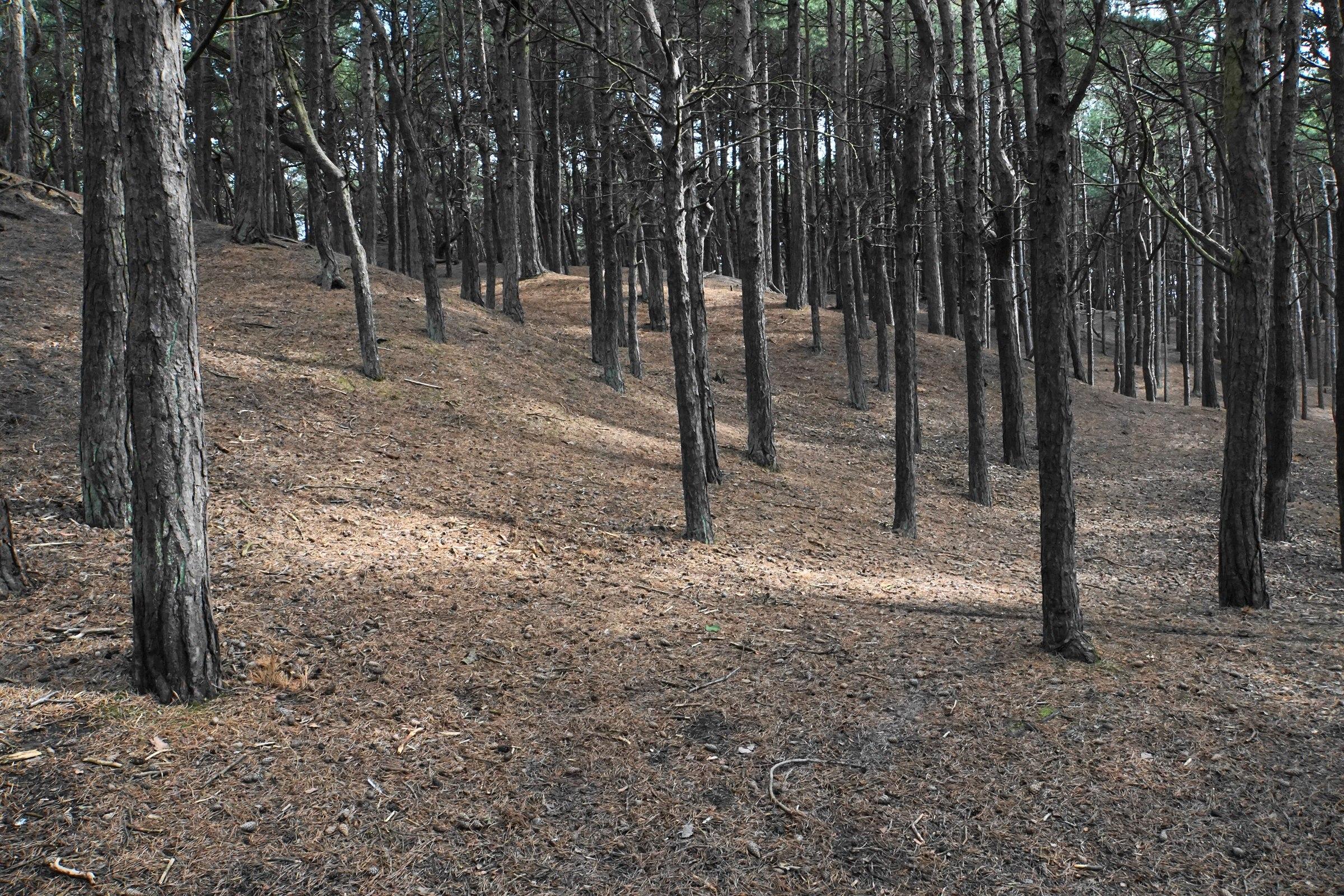
Tall straight pine trunks rise from a needle-covered sandy slope in the pinewoods at Formby.
In the pinewoods at FormbyPhoto: Bill Boaden (CC BY-SA 2.0)

Wildlife

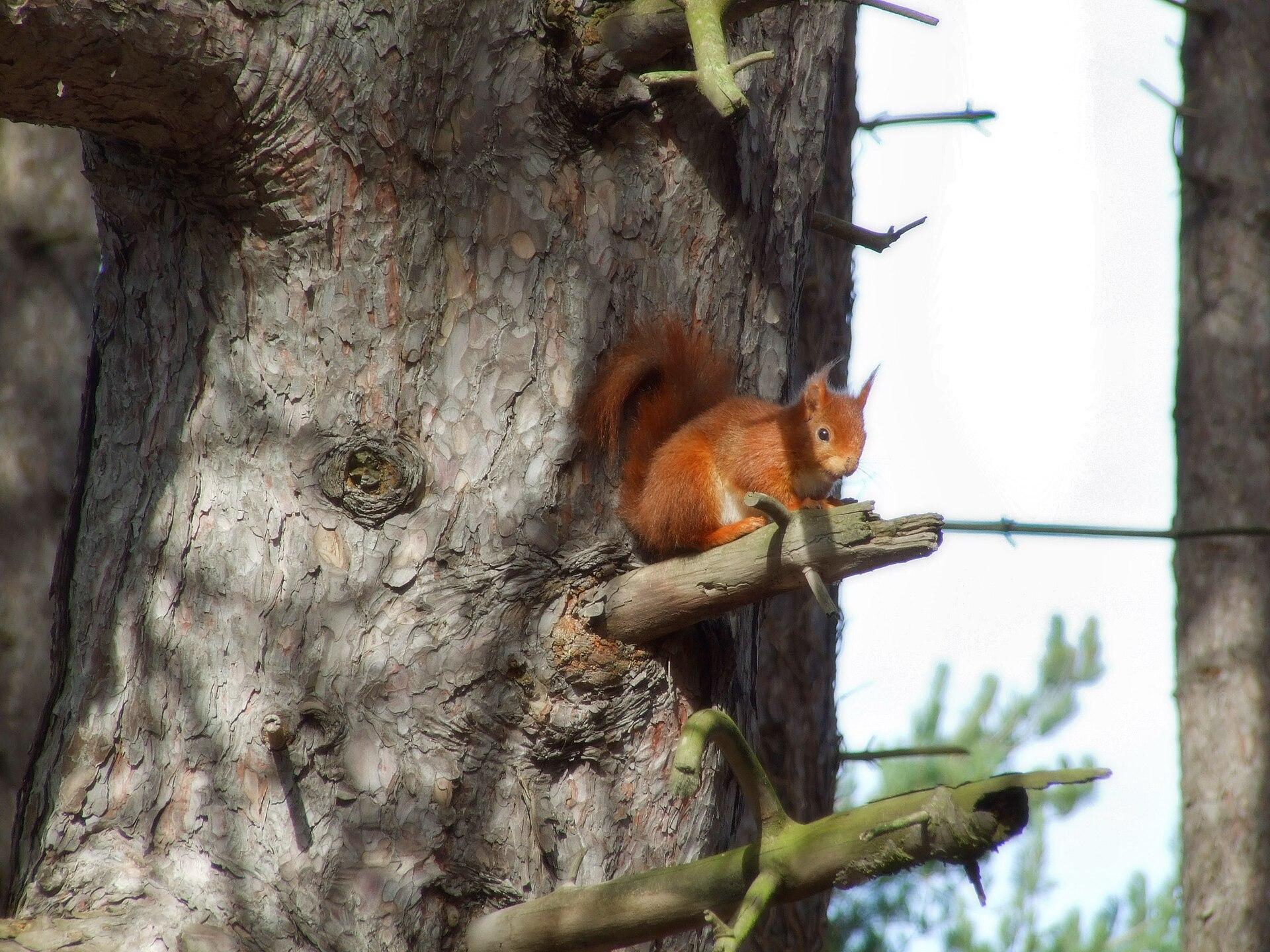
A red squirrel with tufted ears sits on a stub of branch against a pine trunk at the Formby red squirrel reserve.
A red squirrel in the Formby pinewoodsPhoto: SPDP (CC BY 2.0)

Red squirrels

Formby’s pinewoods are one of the few places in England where red squirrels still live wild. Lancashire Wildlife Trust describes the area as the most southerly stronghold for red squirrels on the English mainland. They range across the whole site, and a sighting is never guaranteed.

The population was hit hard by squirrel pox, which arrived in late 2007 and killed an estimated 80 per cent of Formby’s red squirrels by the following year. Numbers have been recovering since. To limit the spread of disease, the National Trust no longer feeds them, so they no longer gather in one spot: look and listen as you walk. More in our red squirrel guide.

Natterjack toads and sand lizards

The shallow pools that form in hollows between the dunes, called slacks, are breeding places for the natterjack toad, one of Britain’s rarest amphibians. The National Trust maintained ten natterjack pools in 2025. Keep dogs and children out of dune pools.

Sand lizards, also rare, bask and lay their eggs in patches of bare sand. Twenty-seven were moved to safety before the rubble was dug out of the dunes in 2025.

Birds of the shore

The flats off Formby are part of the Ribble and Alt Estuaries, internationally protected for the wading birds and wildfowl that winter here. From autumn you can see sanderling, dunlin, knot and curlew along the water’s edge, and skeins of pink-footed geese overhead. Grey seals are occasionally seen offshore, and roe deer live in the pinewoods.

Birds feeding and resting on the tide line need to save their energy in cold weather. Walk around flocks, not through them.

Watching wildlife responsibly

Stay on paths in the dunes and woods. Do not feed the squirrels. Keep dogs out of pools and on a lead near birds and livestock. Take all litter home, and never light a fire. If you find a sick or dead red squirrel, report it to Lancashire Wildlife Trust on 07590 745 862.

History

Prehistoric footprints

Beds of ancient silt lie under the beach at Formby Point, and as the sea wears them away it uncovers footprints pressed into mud thousands of years ago. Researchers at the University of Manchester describe this as one of the world’s largest known concentrations of prehistoric animal tracks, spanning roughly 9,000 to 1,000 years ago.

The prints were left by people and by animals long gone from this coast: aurochs, red and roe deer, wild boar, beaver, wolf and lynx. They appear as patches of dark brown, muddy sediment on the sand. Each exposure lasts only until the tides erase it, so there is no fixed place or time to see them. If you find some, look and photograph, and do not walk or ride across the beds.

The first lifeboat station

A lifeboat station was set up at Formby in 1776 by William Hutchinson, Liverpool’s dock master. The National Trust calls it the world’s first permanent lifeboat station, though exact records from the time have not survived. Its last launch was in 1916.

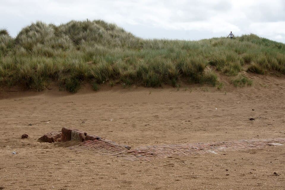
The boathouse later served as a tearoom and was demolished in 1965. Parts of its brick foundations remain on the beach at the end of the bridleway, south of the Lifeboat Road boardwalk, and a blue plaque stands near the Boat Bench by Lifeboat Road car park. The road, the car park and a pub in the village all take their name from it.

Shipwrecks

Several wrecks lie on the sands and banks off Formby and show at low water, among them the steam coaster Bradda, lost in January 1936, and the cargo ship Ionic Star, which ran aground in October 1939.

They are a long way out, more than a kilometre from the dunes in the case of the Ionic Star, across sand that the tide covers quickly. Do not try to walk to them on your own.

A changing coast

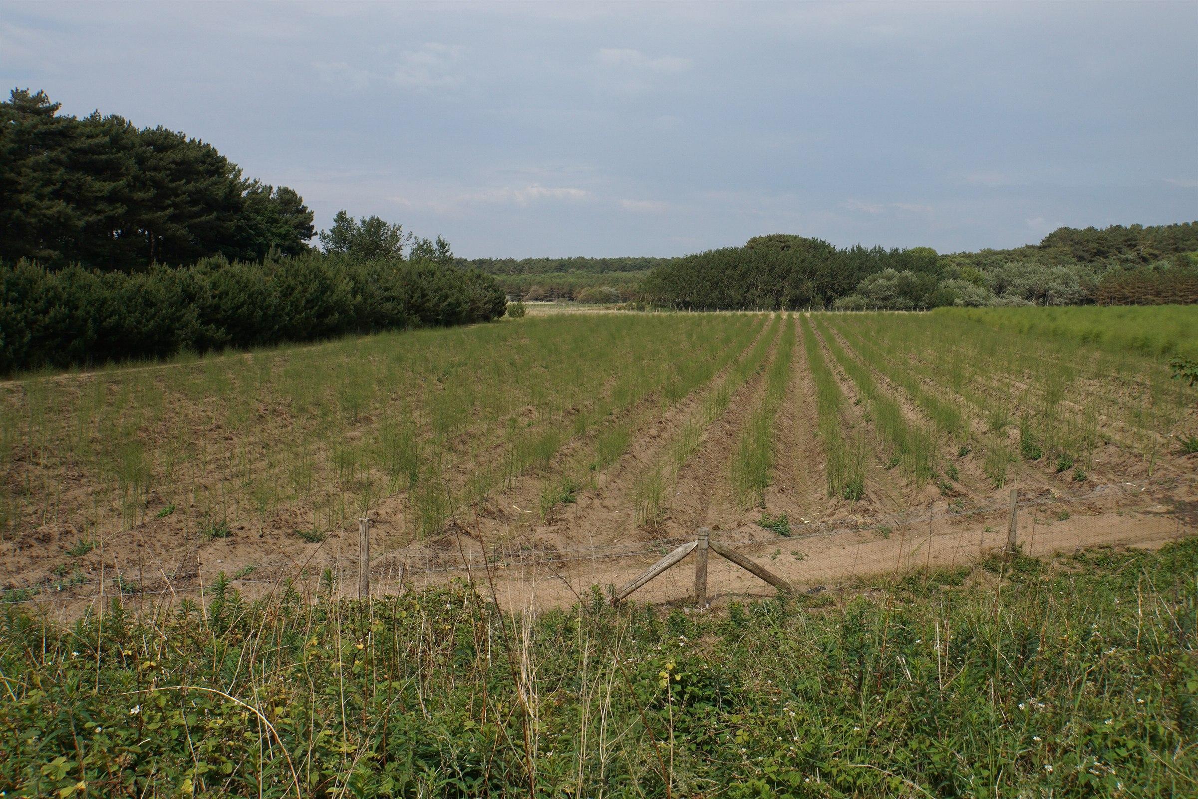
The pines are not native. Local landowners began planting them in the dunes from the late nineteenth century, and the area south of Lifeboat Road was planted in 1901 and 1902. Asparagus was once a noted local crop; the Asparagus Trail passes the old fields and one still in cultivation.

In the Second World War, lights and fires were lit on this coast as decoys to draw bombers away from the Liverpool docks. Afterwards, rubble from the demolished Harington Barracks was tipped behind the beach and a car park was laid over it. Shifting sand exposed more of it each year, until it was dug out in 2025.

At Ravenmeols, south of Lifeboat Road, the Lost Resort Trail follows what is left of Formby-by-the-Sea, a Victorian seaside resort that was planned, begun and never finished.

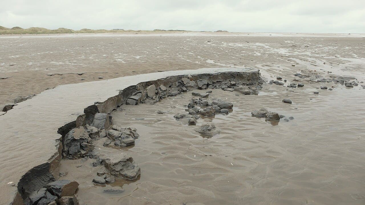
A broken ledge of dark grey silt sediment exposed in wet sand on the foreshore south of Formby Point, with dunes on the horizon; no footprints are visible in this view.
Ancient silt beds exposed on the foreshore. No footprints are visible in this viewPhoto: Gary Rogers (CC BY-SA 2.0)
Low red-brick foundations partly buried in the sand in front of a marram-covered dune: the remains of Formby Point lifeboat station.
Brick foundations of the old lifeboat station on the beachPhoto: Mike Pennington (CC BY-SA 2.0)
Rows of feathery asparagus plants growing in sandy soil behind a wire fence, with pine woodland beyond, at Sandfield Farm, Formby.
Asparagus growing at Sandfield Farm, on the Asparagus TrailPhoto: Bill Boaden (CC BY-SA 2.0)

Suggested visits

Five ways to spend your time, from a quick walk to a full day. All of them work better around low tide.

Two hours

Straight to the sea and back.

  1. Park at Lifeboat Road and take the boardwalk to the beach (15 minutes).
  2. Walk north along the sand for half an hour, then turn back, keeping an eye on the tide.
  3. On the way out, find the Boat Bench and the lifeboat station plaque by the car park.

Half a day

Woods first, then the beach.

  1. Park at Victoria Road and walk the Asparagus Trail (1.5 hours), watching the treetops for squirrels.
  2. Eat your picnic at the tables in the woods.
  3. Follow the path through the pines and over the dunes to the beach, just over half a mile, and time it for low water.

A full day

Both ends of the site, joined by the coastal path.

  1. Start at Victoria Road with the Asparagus Trail in the morning, when squirrels are most active.
  2. Walk the Sefton Coastal Path south to Lifeboat Road (1.5 miles on compacted stone).
  3. Take the boardwalk to the beach for the afternoon. In season this is the lifeguarded stretch.
  4. Return along the sand if the tide is well out, or by the coastal path.
  5. Check what time the car park closes before you set off.

With young children

Short walks, toilets close by, lifeguards in season.

  1. Park at Lifeboat Road for the shortest, pushchair-friendly route to the sand.
  2. Pick up a child wristband from the Welcome Team and write your mobile number on it.
  3. Use the toilets before you leave the car park: there are none on the beach.
  4. In season, set up near the lifeguard hut and paddle between the red and yellow flags.
  5. Another day, try the Cornerstone natural play trail in the woods near Victoria Road.

Car-free by train

No parking charge, and no risk of a full car park.

  1. Take Merseyrail’s Northern line to Freshfield (31 minutes from Liverpool Central, 14 from Southport).
  2. Walk west along Victoria Road for about 1 km to the National Trust entrance, then through the woods and dunes to the beach.
  3. Walk south along the beach or the coastal path and leave by the Kirklake Path.
  4. Follow Kirklake Road for about 1 km to Formby station for the train home.

Last checked against National Trust trail guides and visitor information. Details can change; confirm before you travel.